Mount Damavand: Exploring the Natural Beauty and Conquering the Summit of Iran
How to reach Mount Damavand, the highest place of the middle east
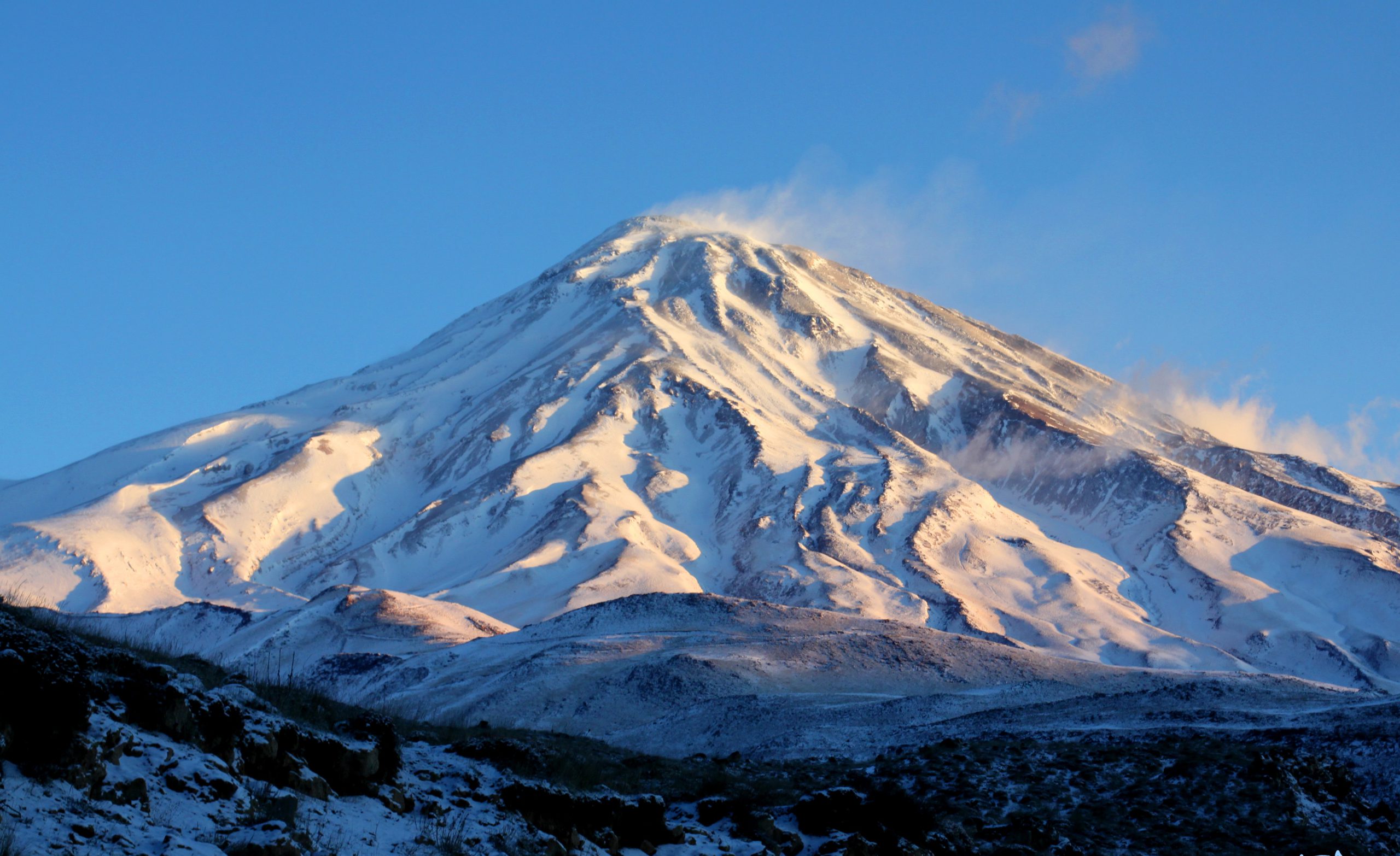
With a height of 5610 meters, Mount Damavand is considered the highest mountain in Iran and the Middle East, as well as the highest volcanic peak in the Asian continent. To reach the peak, you need to climb lower peaks several times and be trained by professional climbers. In this article, we have tried to mention the ways to climb Damavand peak in general. Stay with the “Gate of Nations” to learn about different routes.
South face of Damavand Mountain
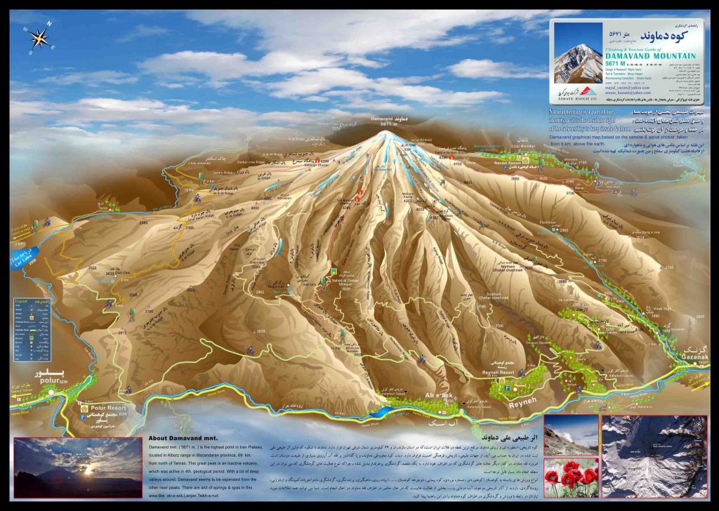
The most frequented among the climbing routes to Damavand peak is the southern route. The origin of this route is the road between Pleur and Reine. In the distance between these two areas, there is a dirt road through which climbers can reach the sheepfold at the beginning of the route. The path goes through the sheepfold towards the first river and then the second river, and by turning to the right and continuing up, it reaches the third camp.
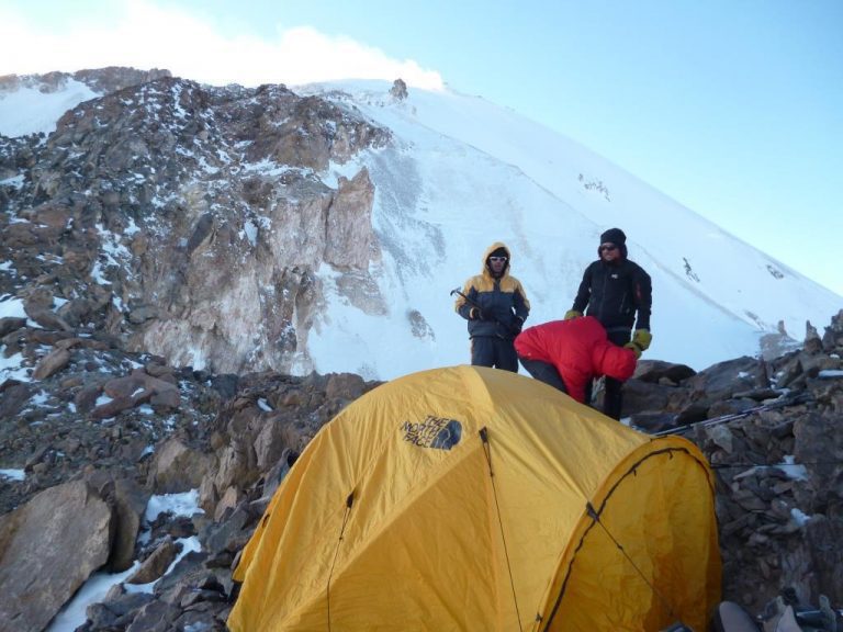
The location of the third court is the location of the shelter of the southern route and the dormitory, buffet and toilet. This camp is located at an altitude of approximately 4300 meters. From here, the path continues to the right after a few hundred meters and climbs up to a height of 5000 meters to the place of the ice waterfall. parallel to the ice waterfall, you go to the left with a traverse and continue along this ridge until Sulfur hill. Then the path slightly inclines to the right and continues to the peak.
Western face of Mount Damavand
This route starts from the western road and in an area known as the western parking. The western parking is located at an altitude of 3,300 meters. Then you will reach the beautiful Simorgh shelter. A two-floor shelter with an approximate capacity of 20 to 25 people, located at an altitude of 4200 meters. The continuation of the path goes up from behind the shelter and after passing through a sandy corridor, it reaches the peak.
North face – Shelters ridge
Relatively the most difficult among the climbing routes to Damavand peak that have shelters. The starting point of the route is Nandel village. Through this village, people are transported by 4WD cars to an area called Sang-Bozorg, and the trekking starts from here. There are two shelters on this route, one at an altitude of 3,900 meters and the other at an altitude of 4,700 meters. Regarding this path, be careful that the path after the second shelter goes up from the right side of the rocky part and passing by the Dobisel glacier.
Northeast face
In the opinion of most mountaineers, the most beautiful route among the climbing routes to Mount Damavand peak is the northeast side. The good feeling of sunrise in the morning and the beautiful view of Yachar glacier always reminds everyone the good memories of this route.
There are two ways to access this path. Gaznak route that starts from Gaznak village. This route is long and will reach Takht Fereydoun shelter at an altitude of 4300 meters through a long ridge. The other route to Mount Damavand starts from Haji Abad village and Ehsani Sheep Farm and is a shorter route. There is another path that is less used. Through the village of Melar in the mining area, you can reach the Sar Stele by traversing the Sardroud Valley and then climbing from the Ser Stele to reach the spring.
After reaching Takht Fereydon, the path starts towards the peak through a specific ridge. At an altitude of 5250 meters, a snowy roof appears, which you will reach the peak by climbing. On stormy days, this route is exposed to strong winds.
Discover a world of adventure on our website, where you’ll find a wide range of thrilling Iran Trekking Tour and Mountaineering Tours, with a special focus on the majestic Mount Damavand. Explore our website now to unlock a world of possibilities and start planning your unforgettable journey to conquer the heights of Damavand and beyond.”


